IMAGE: ALEX TREADWAY/ICIMOD
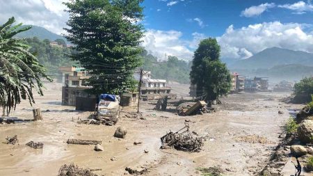
AT APPROXIMATELY 5:45 on the morning of July 8th 2025, a supraglacial lake in Tibet’s Jilong County (a meltwater pool that satellite data shows had grown from a small pond in December 2023 to cover 638,000 square metres by the previous day) breached its ice dam without warning. No heavy rain had fallen. There was no seismic event. The water and debris it released tore down the Bhotekoshi River valley, swept away the Nepal-China Friendship Bridge at Rasuwagadhi, damaged four hydroelectric projects and knocked out an estimated 200 megawatts of generating capacity, destroyed a kilometre of highway, buried more than 100 cargo containers and electric vehicles at the border customs yard, killed at least nine people and left 19 more missing. Cross-border trade with China halted. The lake, measured at 638,000 square metres on July 7th, had shrunk to 435,000 square metres by the time investigators reached the site. The missing 203,000 square metres had become a disaster.
This event was not unprecedented. In August 2024 a glacial lake outburst flood from Thyanbo Lake in the Solukhumbu district, in the Everest region, destroyed infrastructure downstream and displaced 135 residents. In May 2025 two glacial lakes burst above Tilgaon in Humla, destroying five bridges and damaging local hydropower infrastructure, again without preceding rainfall. In July 2025 a lake of just 0.016 square kilometres in Upper Mustang (smaller than many Kathmandu neighbourhoods) released enough water to destroy four bridges 35 kilometres downstream.
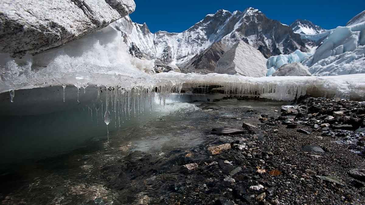
Since the 1970s Nepal has recorded 26 glacial lake outburst floods. The average number of such events per decade across the Himalayas is nearly five times higher than before 1950, according to the United Nations University, an academic arm of the United Nations. The frequency is not a statistical coincidence. The Himalayas are warming at roughly twice the global average rate, and the lakes that form on and around retreating glaciers are growing in number, as well as area and instability.
Nepal’s specific exposure to this trend is enormous and inadequately accounted for in how the country plans its economic future. ICIMOD, a Kathmandu-based research organisation, has mapped 3,624 glacial lakes of measurable size across Nepal’s three major river basins. Forty-seven are classified as Potentially Dangerous Glacial Lakes on current monitoring criteria.
Yet the events of 2024 and 2025 have exposed the inadequacy of that threshold: Thyanbo Lake, which caused the Thame disaster, covers only 0.05 square kilometres—well below the size typically flagged for scrutiny. Finu Shrestha, a remote sensing analyst at ICIMOD, told Dialogue Earth in September 2025 that “tiny and short-lived glacial lakes are becoming more hazardous than previously perceived”. No comprehensive national study of glacial lakes has been conducted since 2015. Nepal is making infrastructure decisions based on a decade-old map of a landscape that is changing season by season.
The macroeconomic threat is concentrated in a single sector. Hydropower is Nepal’s most significant planned export commodity and the centrepiece of every growth strategy since the 1990s. The government’s current budget, presented in May, assumes accelerating electricity exports to India as a key driver of the 7% growth target.
Nepal’s hydropower projects sit in the same Himalayan river valleys—the Bhotekoshi, the Koshi, the Gandaki, the Karnali—that receive glacial meltwater and that GLOFs travel through at destructive velocity. A study cited in the journal npj Natural Hazards estimated potential hydropower losses of $8.98bn for the Imja Tsho catchment alone under a worst-case scenario.
The July 2025 Rasuwagadhi event, which destroyed 200 megawatts of installed capacity in a country with some 4,200 megawatts total, demonstrated the speed at which those losses can materialise. The UNDP notes that a single GLOF event can cause economic losses surpassing $100m, equivalent to nearly twice Nepal’s annual FDI inflow.
The problem is compounded by geography that Nepal cannot control. The July 2025 Rasuwagadhi flood originated in Tibet. The 2016 Upper Bhotekoshi disaster, which caused more than $70m in damage, also originated in Chinese territory. Chinese authorities have identified 25 lakes on their side of the border as “extremely dangerous” and draining towards Nepal. There is no binding joint monitoring framework between China and Nepal. Nepal’s early warning systems, where they exist, are calibrated for precipitation-triggered floods; the July 2025 event arrived without rain, making those systems useless. The transboundary dimension means Nepal is partly exposed to hydrological risks it cannot independently monitor or mitigate.
What Nepal does have is a $36m Green Climate Fund project targeting the four highest-priority lakes—Thulagi, Lower Barun, Lumding Tsho and Hongu 2—with drainage interventions and early warning infrastructure. Forty-seven lakes are classified as dangerous. Four are being addressed. The response, as the UNDP itself acknowledged in July 2025, has “remained largely reactive and project-based”. Each event is assessed and treated as an exceptional disaster. The pattern they collectively form—a systematic, climate-driven assault on the river valleys where Nepal’s economic future is physically located—has not yet produced a systematic response.
Finance minister Swarnim Wagle’s growth projections depend on hydropower revenues from rivers that are increasingly fed by, and periodically destroyed by, the same melting ice his country has no capacity to preserve. ■