IMAGE VIA SETOPATI
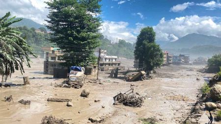
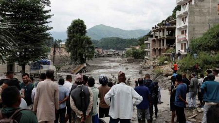
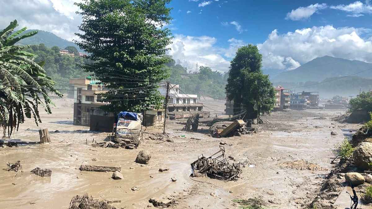
ON THE morning of August 26th, a massive ice-rock avalanche tumbled from a high-altitude slope near the Nepal-Tibet border. It slammed into the Lhende Khola, a small tributary of the Bhote Koshi river system, blocking the channel before releasing a sudden surge of water and boulders. Within thirty minutes, the water level at Galchhi, more than 100 kilometres downstream, had risen by nine metres. By the time the flood had passed, it had swept through the Bhote Koshi and Trishuli river corridors, across eight districts from Rasuwa to Chitwan, carrying away homes, bridges, vehicles and people.
Six days later the confirmed death toll stood at 1,127. Another 4,858 people remained unaccounted for. More than 11,000 had been rescued. The United Nations estimated that at least 2.2 million tonnes of debris had been deposited along the affected river system, including more than 556,000 tonnes of building rubble from over 2,300 damaged structures. The International Federation of Red Cross and Red Crescent Societies, which had only just managed to access the worst-hit areas, described blocked waterways and the continuing monsoon as posing a “real and immediate” threat of further flooding and landslides.
The proximate cause of the disaster was not a conventional glacial lake outburst flood—the sudden release of water from a dammed glacial lake. Scientific assessments point instead to a high-altitude ice-rock avalanche that temporarily blocked a river before giving way. But the underlying conditions are undeniably climatic.
The International Centre for Integrated Mountain Development (ICIMOD), a Kathmandu-based intergovernmental body, had warned five months earlier that accelerating glacier melt was raising the risk of such events. In reports released in March, ICIMOD found that glaciers in the Hindu Kush Himalaya had shrunk by nearly 12 per cent in area between 1990 and 2020, and that the rate of ice loss had doubled since 2000. Temperatures in the Himalayan region had risen by 1.8 degrees Celsius, according to Nepal’s Prime Minister Balendra Shah, who said there was “no doubt that climate change has caused this disaster”.
The scale of destruction has forced a reckoning with the economic toll. Preliminary estimates from Change Initiative, a global research organisation, placed losses at between $1.38 billion and $2.7 billion, with a central figure of $1.95 billion—equivalent to 4.3 per cent of Nepal’s gross domestic product. Other assessments have suggested the damage could top $5 billion, roughly a tenth of annual economic output.
The floods knocked out at least eleven hydropower stations and one solar plant, representing about 431 megawatts of capacity, and damaged another fifteen projects under construction. Forty-one bridges were destroyed; sections of the Prithvi Highway—the main route linking Kathmandu Valley with western Nepal—remained blocked; and the 42-kilometre Betrawati–Rasuwagadhi road sustained extensive damage. More than 3,400 displaced people were living in 27 makeshift sites, mostly in schools, with relief supplies failing to reach some remote communities entirely.
The disaster has also exposed Nepal’s peculiar vulnerability as a country that contributes virtually nothing to global greenhouse gas emissions but stands directly in the path of glacial meltwater. Foreign Minister Shishir Khanal described Nepal’s emissions as “virtually negligible” while it bore what Kathmandu saw as a disproportionate share of global warming’s consequences. The same Himalayan corridor had flooded in July 2025, claiming nine lives and causing millions of dollars in damage. What was once a rare event is becoming common.
Nepal’s tourism industry, which contributed 6.6 per cent of GDP and supported more than a million jobs in 2023, now faces what one operator called an “existential crisis”. Among the missing are some 600 foreign tourists, many of them pilgrims bound for Mount Kailash in Tibet. Travel companies are scrambling to reassure clients that most of the country, including the Everest and Annapurna regions, remains unaffected, but the images of tsunami-like waves sweeping through mountain villages have alarmed visitors planning trips during the peak autumn season.
The disaster originated near the border and its management will require cooperation that has historically been patchy. Change Initiative has called for stronger Nepal-China collaboration on high-mountain risk monitoring, data sharing and early-warning protocols. ICIMOD has identified more than 25,000 glacial lakes across the Hindu Kush Himalaya, roughly 200 of which are considered dangerous. In the Koshi basin alone, a 2020 assessment mapped 3,624 lakes with 47 potentially dangerous. Many of these lie on the Chinese side of the border, beyond Nepal’s direct monitoring capacity.
The rescue effort has mobilised more than 21,000 security personnel. Indian tunnel-rescue teams have been deployed to search for survivors trapped in hydropower tunnels. But with the monsoon still active and water levels in three major rivers—the Sun Koshi, the Budhi Gandaki and the Mahakali—having crossed alert levels as of September 2nd, the risk of further flooding has not receded.
The UN has warned of growing public health risks from overcrowded shelters, contaminated water and damaged health facilities, with six health facilities destroyed or damaged and two others unreachable. Some 43,000 women and girls now need immediate humanitarian assistance, according to UN Women.
The August 26th flood was a consequence of ice and rock, weakened by heat, giving way. The same process is playing out across thousands of Himalayan glaciers, many of them poorly monitored. Nepal’s tragedy is a warning rather than an outlier. ■